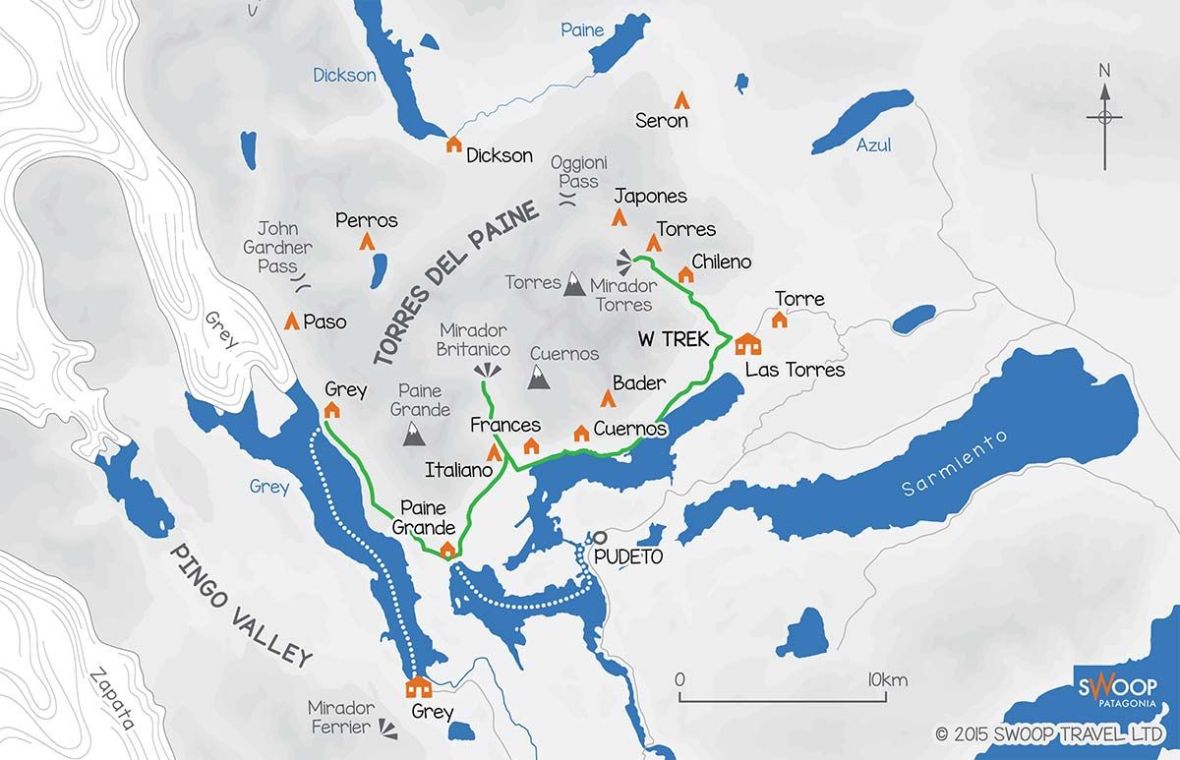
The W Trek in Torres del Paine National Park is a multi-day hike that features some of the most stunning landscapes and highlights of the park including the Base Torres, the French Valley and Grey Glacier. It’s no wonder it’s one of the most famous hikes in the world. James and I had seen pictures of Patagonia and its dramatic landscapes, and once we decided to head to South America we knew we had to see it on our own!
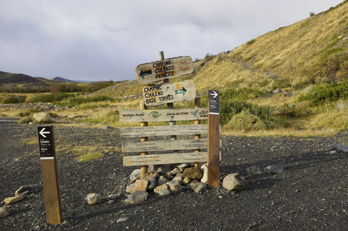
There are many things to consider when heading to Torres del Paine (how many days do you want to hike? are you looking to camp or stay in refugios? will you bring your own gear? do you want a professional guide?) and I plan on answering these in a separate post, but for now I wanted to share our experience. We decided to do the W over 5 days, hiking East to West using Puerto Natales as a base to get to and from the park.
Day One had us transferring to Torres del Paine National Park from Puerto Natales, dropping our stuff at Torre Central and doing the day hike to Los Torres; to get a good start on the day we took the first bus we could from Puerto Natales at 7:00am.
Because I love a good video, check out ours below. Get ready for three minutes of watching us walk, with our nerdy trekking poles (I don’t care what anyone says, they are a lifesaver for your knees!).
I’ve included a brief breakdown of the hike with the distance and times and, just for fun, the Fitbit steps* (which matched James’ Apple Health steps pretty well).
*Fitbit steps are for the whole day, not just the hike – though 90% or more of the steps we were doing in a given day were part of the hike.
Day One: Refugio Torre Central to Base Torres
Distance: 18km Return
Time: 6.5 hours
Fitbit steps: 35,776
We arrived at Laguna Amarga at 9:00am, paid our park fee and were given maps and a quick tutorial before we got onto a shuttle heading to Torre Central (arriving there by 9:40am). We checked in and dropped off one of the bags, taking only a day pack with some water, snacks and our camera.
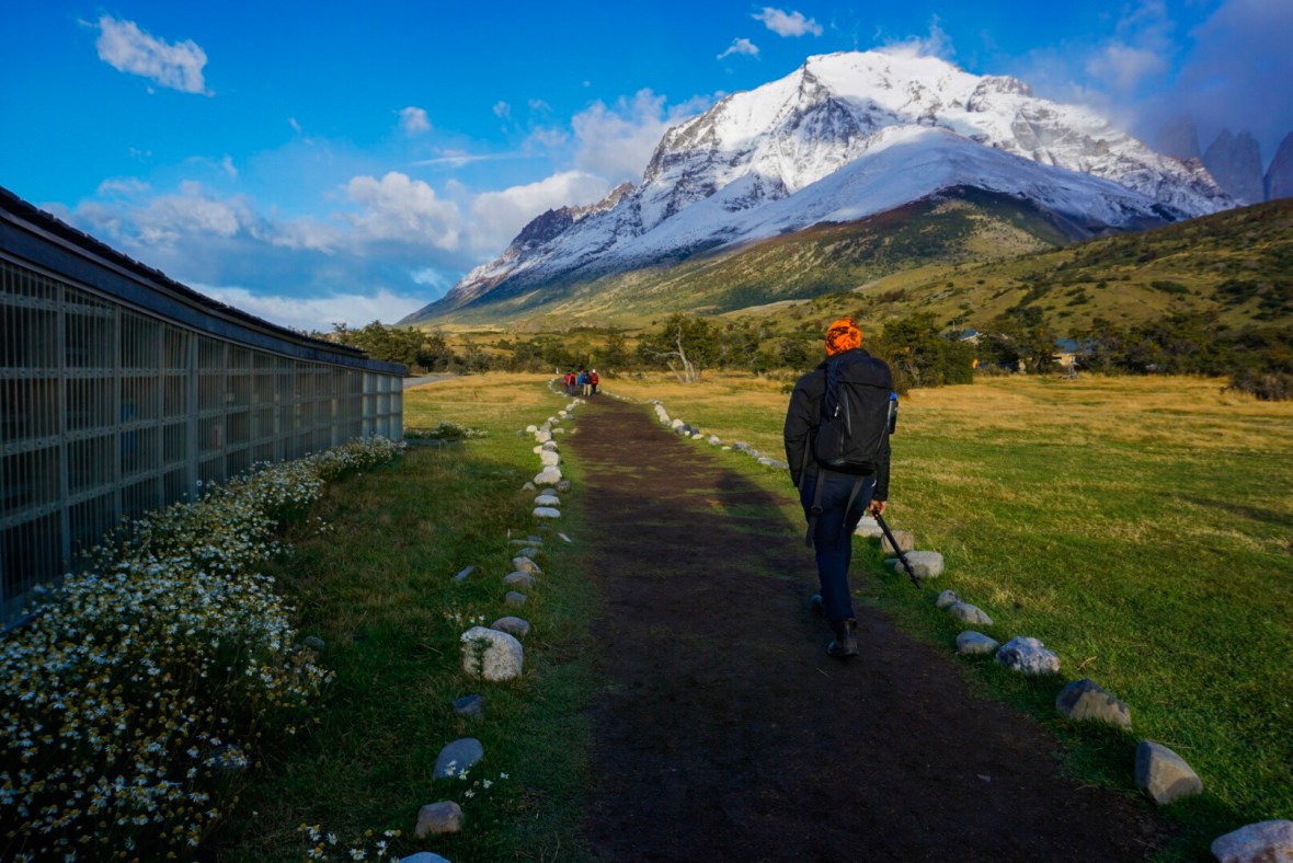
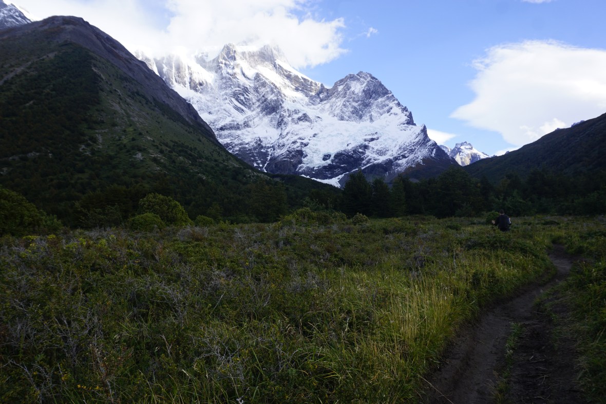
Just before 10am, we were on the trail heading past Las Torres Hotel and on our way to Base Torres. The day couldn’t have been better; the air was crisp and the sun was shining. I had to admit I was nervous about hiking the W during the shoulder season; our research uncovered that most tour companies basically pack up as of April so what did that mean for us?! 30 minutes into the hike we were stripping off our light rain jackets and fleeces, so luckily the weather was cooperating with us.
As we climbed, we had a gorgeous view of Lago Nordenskjold, and I was blown away by how blue the water was. As we rounded the corner past that lookout, the notorious Patagonian winds started and we were soon putting our jackets back on. But the sun was still shining, and the views provided all the motivation we needed. I started to take in all the gorgeous fall colours, it was clear the leaves were just starting to change.
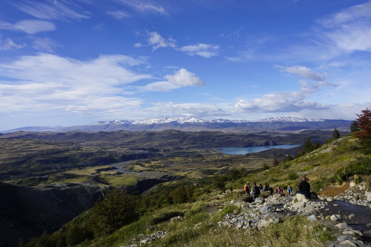
Before we knew it (2.5 hours after leaving Torre Central) we arrived at Chileno, another one of the camps. From here the trail got busier, but there were still periods where we couldn’t see any other hikers and as we entered the woods I got another opportunity to appreciate the changing leaves.
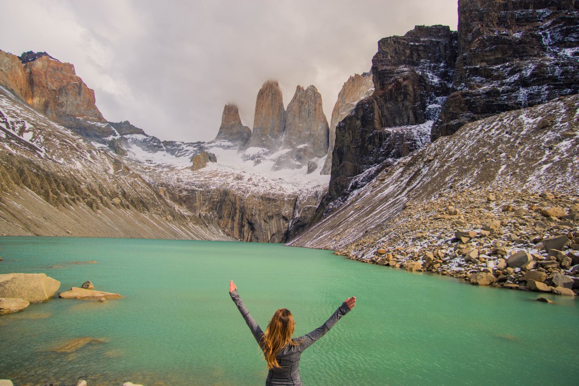
We walked past streams, over wooden bridges and, every so often, we were rewarded with a clearing that provided outstanding views. Around 12:30pm we arrived at the last lookout before our climb up to Base Torres. Again I had to say a little thank you to the weather gods for giving us such a gorgeous day.

The last bit was definitely steeper, and this is where the trail really started to jam up as there were groups of people moving both up and down the mountain. We had trekking poles (which I honestly used to think were the nerdiest thing ever, but after using them on Kili I was converted) which helped us climb, especially at the top where there was snow and ice. One thing that struck both James and I was the footwear choices some people made! Some people were hiking in Adidas sneakers, or shoes equivalent to Toms and just slipping all over the place!
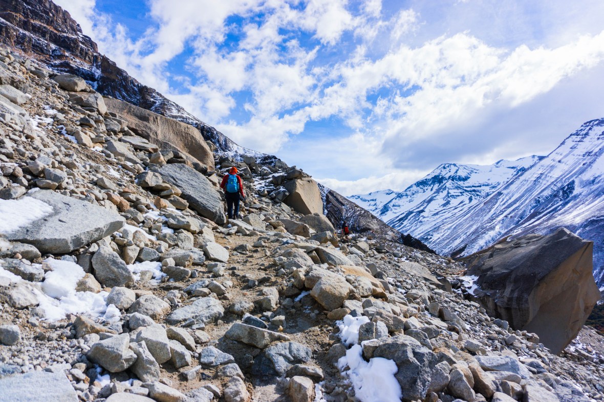
I think all can agree, regardless of footwear and complexity of the climb that once you get to the top it is totally worth it. We arrived just after 1:00pm and spent a good half hour eating some lunch, taking pictures and marvelling at the view. It was pretty busy, there’s no denying it, and it made me wonder how busy it gets in the high season. This is undoubtedly the busiest part of the W, as many complete this as a day hike from Torre Central. You could, theoretically, do this hike in a day leaving from and returning to Puerto Natales. While we loved this hike, we were happy in the days following to have a whole lot more space on the trails!
We started the descent, which was easy (especially with our poles!). As we passed Chileno the weather started to turn a little; the sun disappeared and the wind really picked up. When we arrived back around 4:30pm we were happy to have a warm shower and rewarded our efforts with a glass of wine. Not long after we returned, the rain started and didn’t stop until the following morning.
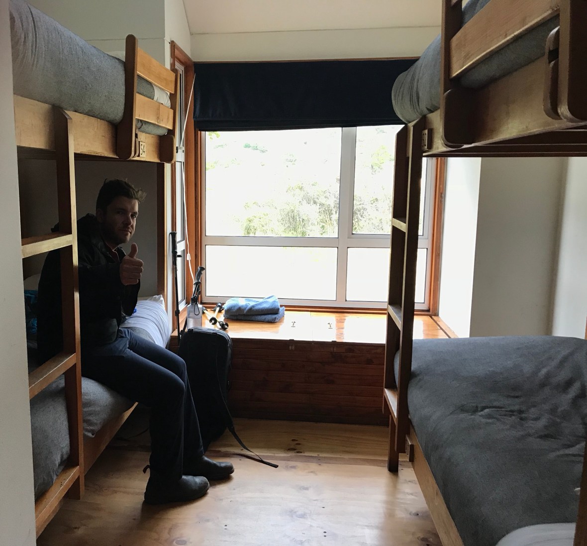
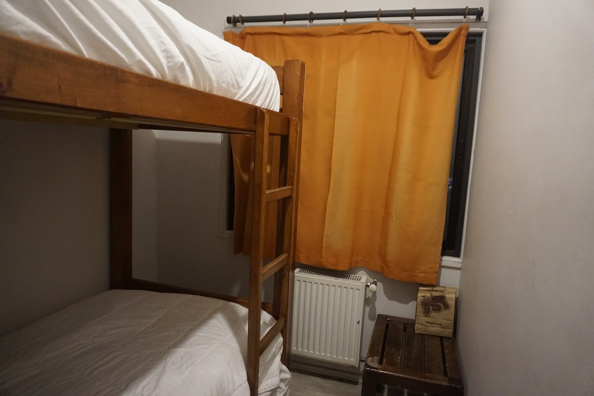
Throughout the hike, we opted for the refugios (again, not really sure what to expect weather-wise, we didn’t want to risk camping without the appropriate warm clothing) and I’ll write more about these in my next post. But Torres Central was the nicest all-around refugio we stayed in; the rooms hold 6 (though we only had one other person in ours), the beds are new and comfortable and there are quite a few common spaces to hang out in.
After a big dinner and some downtime, we turned out the light and slept soundly until the next morning.
Day Two: Torre Central to Cuernos
Distance: 13km
Time: 3 hours
Fitbit steps: 23,624
We knew Day Two was going to be our shortest hiking day (other than the backtrack hike on Day 5) so we took our time in the morning. Around 8:45am the rain seemed to subside, so we decided to make a move and were on our way by 9:00am. The beginning of the hike is the same as to Base Torres and James joked about how we should have stayed in the hotel which is 1km closer to the trail than our refugio.
The sun was out, but the clouds weren’t far away and not long after we set off, it started spitting which resulted in some pretty incredible rainbows against the backdrop of mountains. I was still convinced we were going to have beautiful weather for our hike.
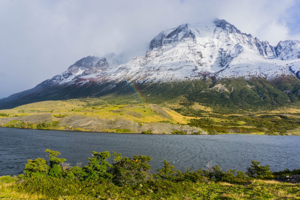
The hike to Cuernos takes you along Lago Nordenskjold which was gorgeous, despite the sun starting to disappear. Though I will be honest, this is not the most exciting hike and you can tell from the number of pictures we took (not many) that it wasn’t as spectacular as other days on the W.
About 2 hours into the hike the wind really started to pick up and not long after the rain came. But, looking on the bright side, it wasn’t very heavy and all of our clothes and technology were in drybags inside our backpacks.
The last half hour was probably the worst weather-wise, but we knew we were getting close and it wasn’t long before we could see the cabins from Cuernos ahead of us.
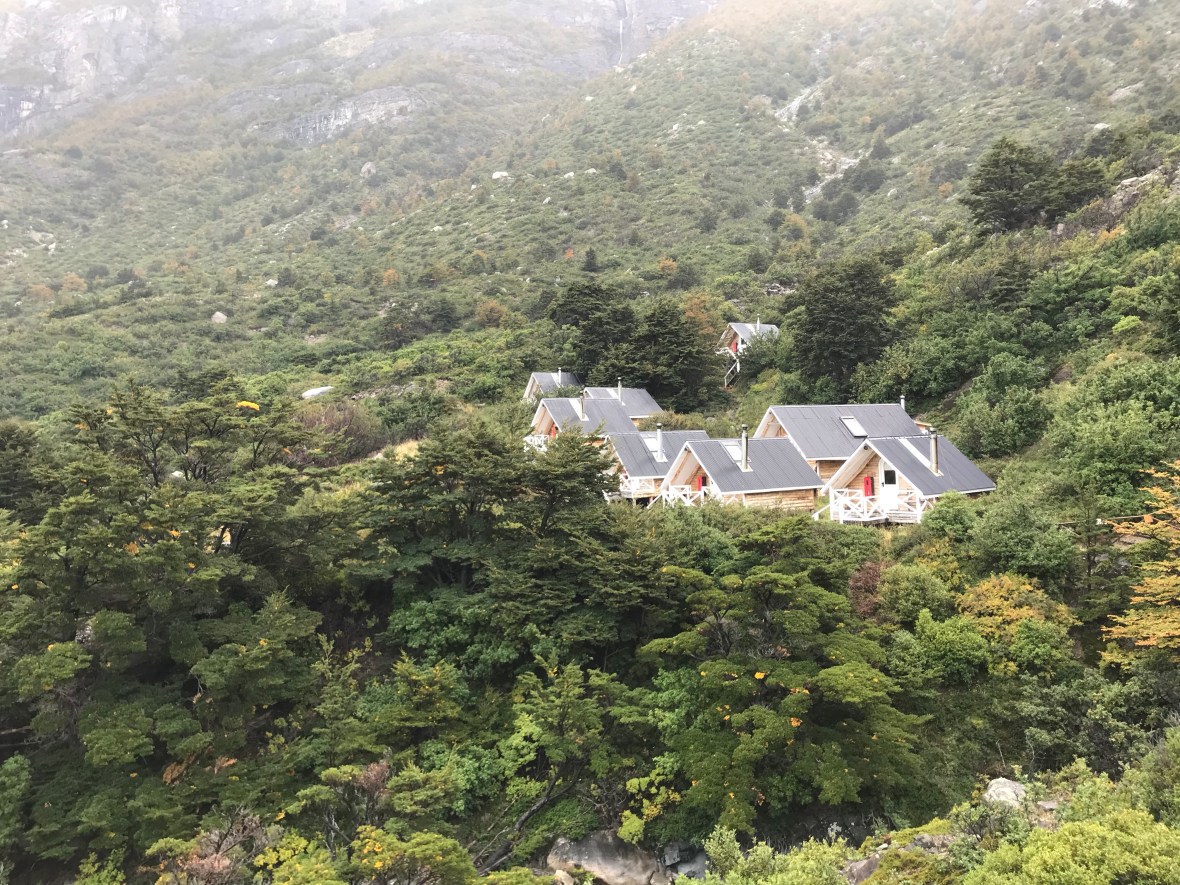
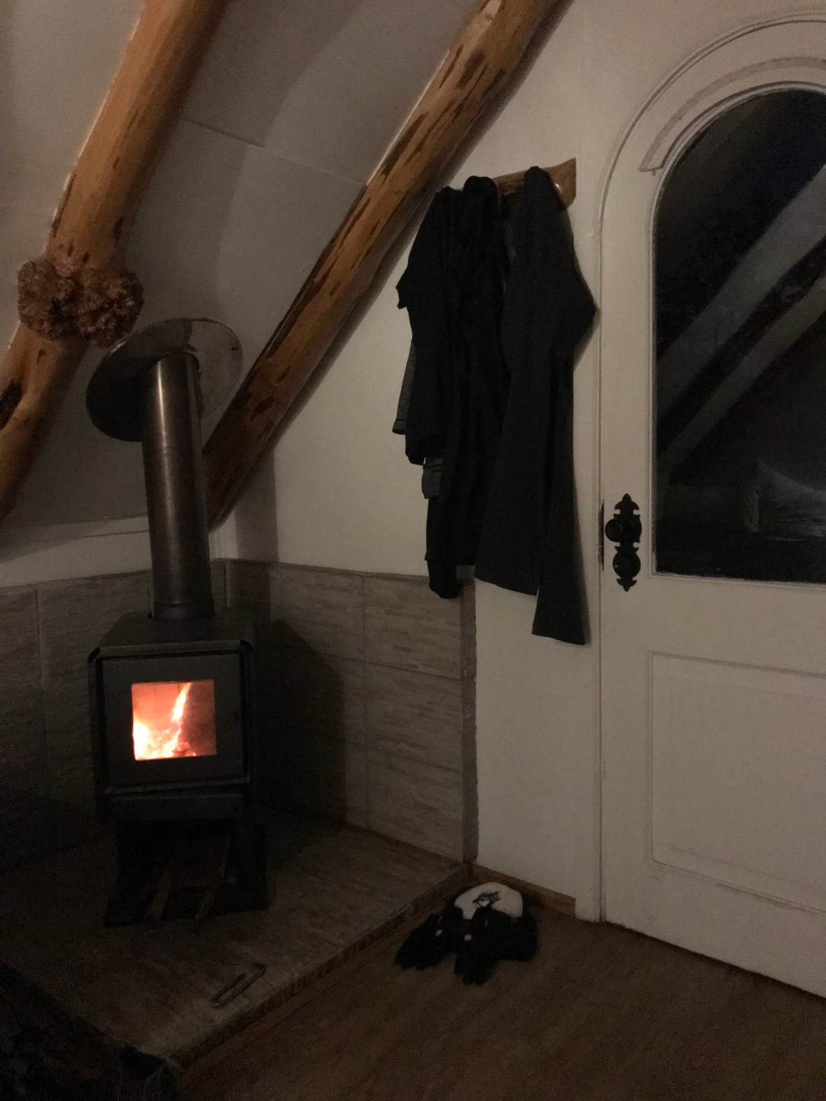
We were cold and damp when we arrived around noon, and while we waited for our cabin we were offered coffee and tea which helped warm us up. We were then taken up to our private cabin, which was the furthest away from the main building and a bit of a scramble downhill to get to the shared washrooms (it was cabin #8; if you’re planning on staying in a cabin at Cuernos and book ahead of time, and not 10 days prior like us, see if you can get one of the cabins closer to the main building). We had a wood burning stove in the cabin, but it wasn’t lit yet so we got out of our wet clothes, into dry ones and under the covers to get warmed up.
Mid-afternoon someone came up to our cabin to light the fire and they came again during dinner to check on the fire. Once the fire was on the cabin was toasty to say the least! We noticed some of our neighbours had their doors open to let some fresh air in, but the wind and rain were still going strong so we just enjoyed the heat.
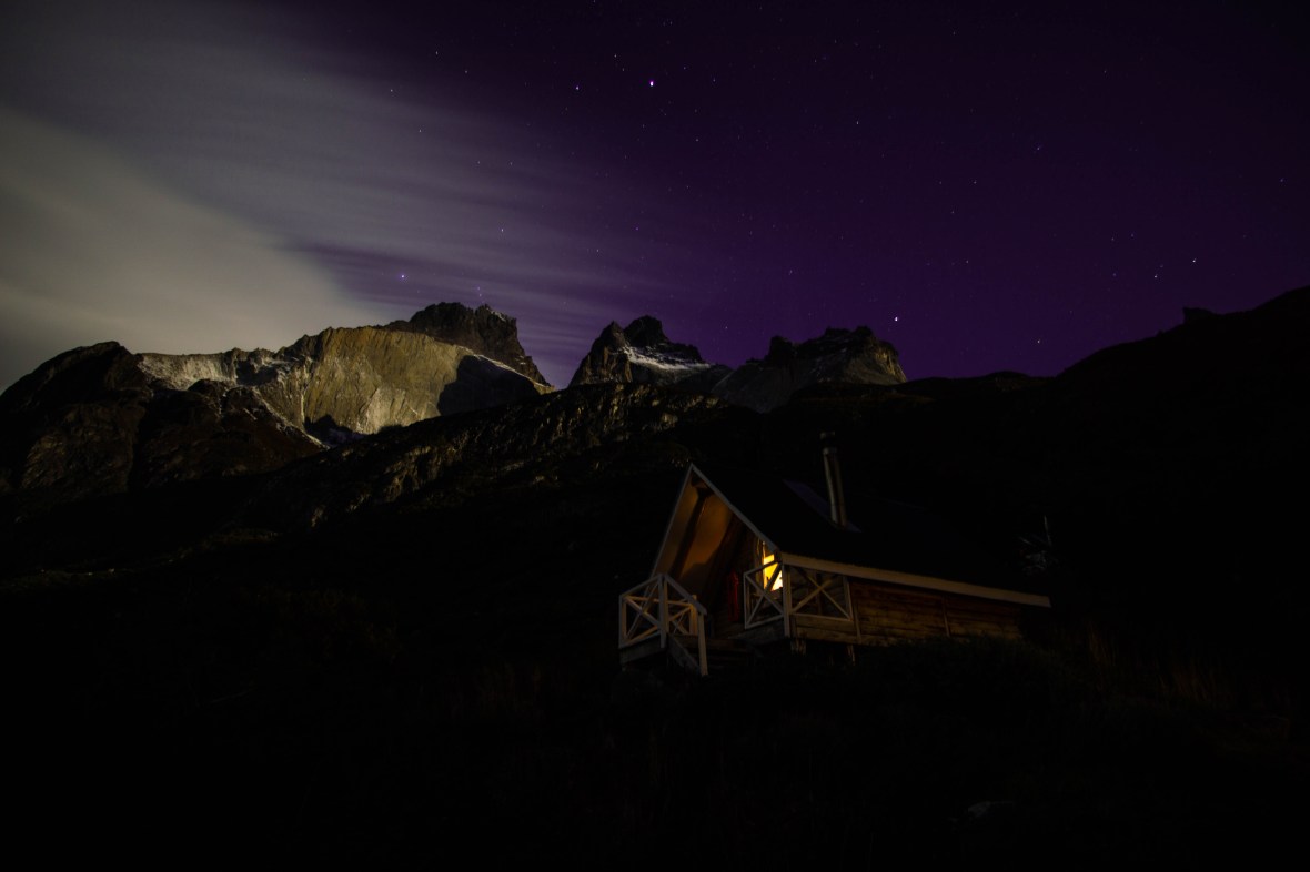
The rain died down around dinner but the wind went strong all night; at times it felt like our cabin was going to blow right over and I hoped for the campers they had some protection from the wind.
Day Three: Cuernos to Paine Grande (plus Frances Lookout)
Distance: 18km
Time: 6.5 hours
Fitbit steps: 32,411
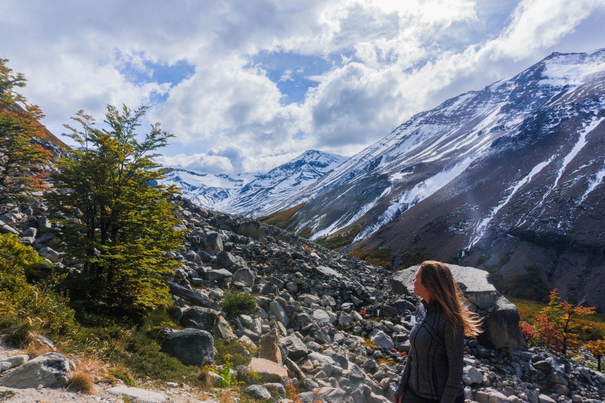
On day 3 we were out the door by 8:45am and it looked like we were once again going to be blessed with good weather. The start of the hike took us through forest, and it wasn’t long before we were at Frances camp (where some opt to stay during the W). We walked through the campsite toward Italiano, which lead us through a valley providing some epic views of the mountains.
From Italiano, there are a few lookout points, and so you have the option to leave your bags at the ranger station before beginning the climb.

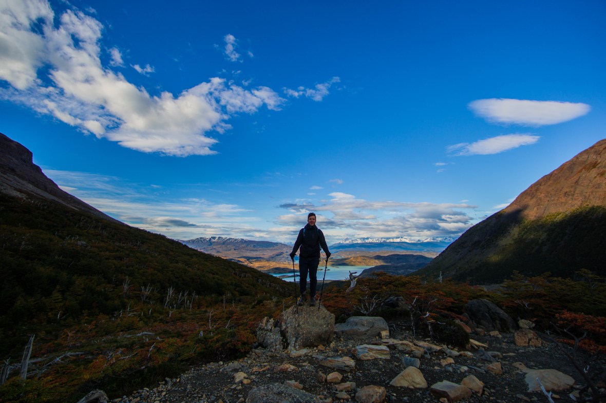
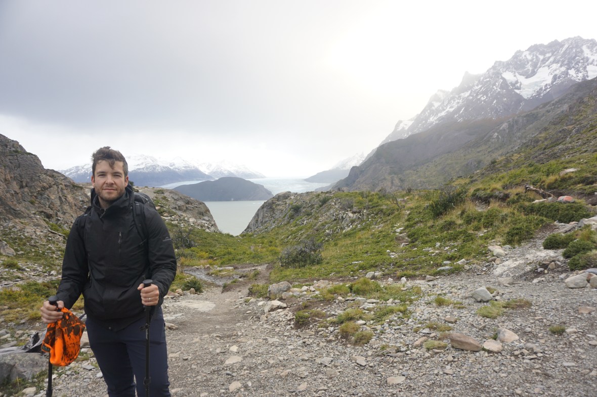
Because we already had a big day, we decided to hike the Frances viewpoint and not all the way to Brittanico; from what we could gather it would add 8km and 4 hours to the day, but I’m still not 100% sure that is accurate. Regardless, the views from Frances were incredible – of the lake, the mountains and the Torres. We stood and watched (and heard) a few avalanches coming down the mountain in the distance. We spent nearly a half hour up there taking in the views and having some lunch.
We grabbed our bags from Italiano, and headed toward Paine Grande. This started with one of the many bridges found along the trail that is limited to 1-2 people. This particular bridge was limited by 1 person, with lines on either side; still we were able to cross after about 5 minutes but the line on the other side must have been 20 people long! Just another opportunity to soak up the surroundings I suppose.
The hike to Paine Grande took 2.5 hours, and was one of the most interesting landscapes. There are boardwalks among the trails leading you through a severely damaged area of the park from an illegal fire started by a camper in 2011. The devastation was jaw dropping, going all the way up the mountain (I later read that the fire destroyed more than 43,505 acres forcing closure for several weeks). The constant message of not starting fires or smoking on the trail that was hammered into us during orientation was starting to make even more sense.

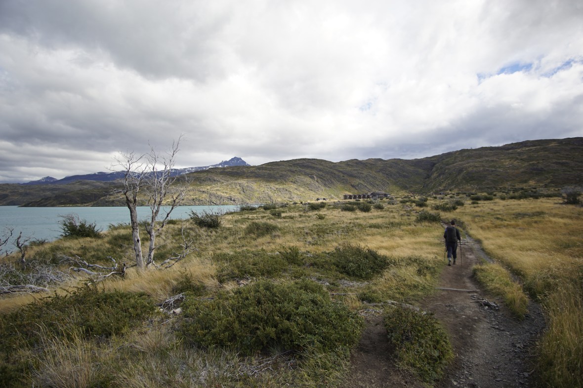
We came around a corner and had views of Lago Pehoe, a beautiful turquoise, which Paine Grande sits along the edge of.
We checked into our room which, surprisingly and happily, ended up being a private room with just one bunk. There are a lot of common areas to hang out in at Paine Grande, complete with rooms that have wood burning stoves and clothing racks beside to dry clothes or towels.
We went to bed early, ready for our last big hiking day to Refugio Grey and the two suspension bridges past Grey on the way to Paso.
Day Four: Paine Grande to Refugio Grey (plus Hanging Bridges)
Distance: 20km
Time: 5.5 hours
Fitbit steps: 32,095
After a breakfast of eggs and toast, we were out the door and on our way by 7:45am to our last stop of the trek – Refugio Grey. On the map we received at Laguna Amarga, there was an angry looking face icon on this part of the hike, which we deciphered (from looking at the legend) meant strong winds.
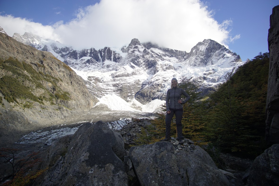
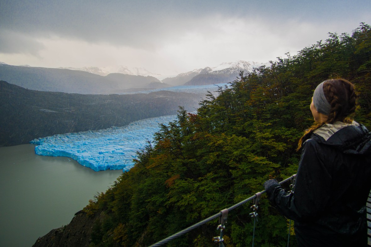
We walked away from Lago Pehoe and through a valley, largely protected from the wind. But the skies were grey, and it wasn’t long before a light drizzle began. I figured as long as it didn’t become torrential that would be fine and, hey, we’d made it through the first 3 days relatively unscathed from Patagonia’s notorious ‘4 seasons in a day’. About 2/3 of the way to Refugio Grey we came to a lookout where we could see the infamous glacier; even from this distance it was super impressive, as were the blocks of bright blue ice floating away from the glacier into Lago Grey.

The wind certainly started to pick up during this exposed part of the hike, but the rest of the way to Refugio Grey was downhill so we kept our heads down and continued walking.
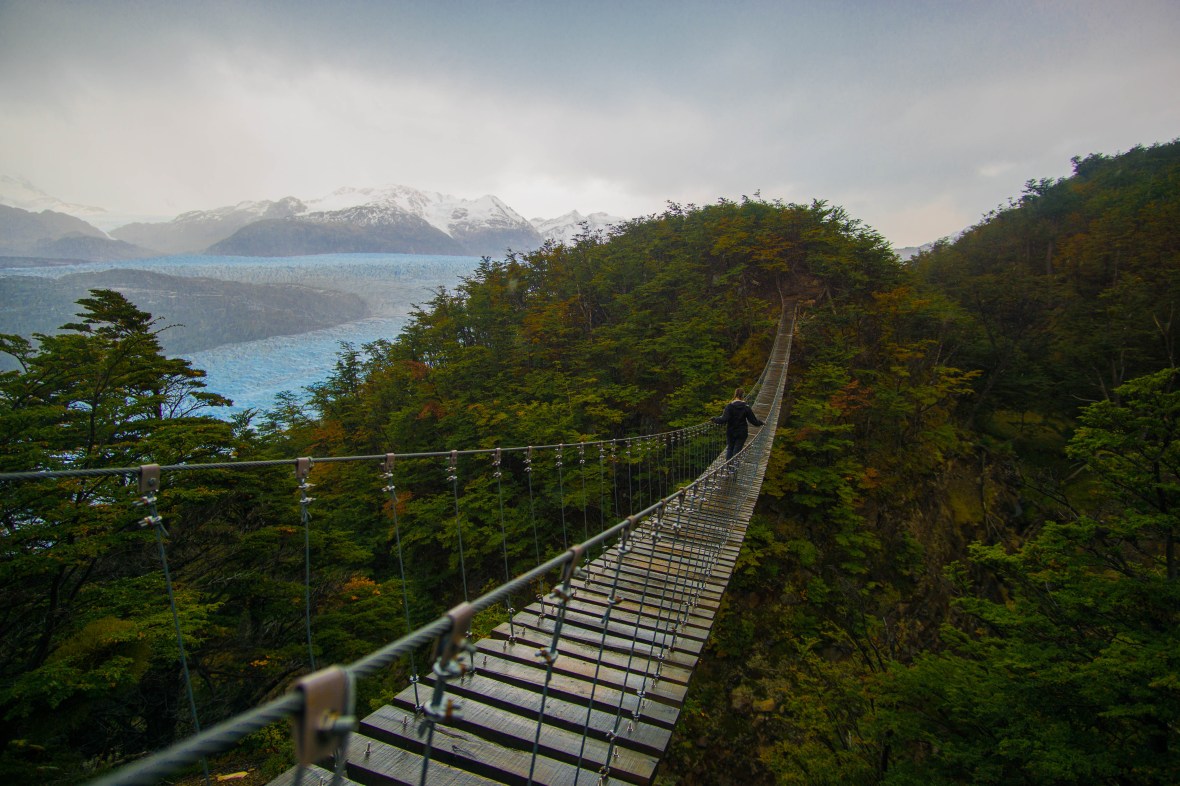
We arrived at the Refugio 3 hours after leaving Paine Grande, dropped our poles and headed in to see if we could leave a bag and suss out how far away the hanging bridges were. There didn’t appear to be anyone working (we were too early for check in) but after 10 minutes someone appeared and pointed in the direction of a storage closet to leave our belongings. She told us it was about 45 minutes to the first bridge, and another 45 to the second which sounded great to us (on the map, it looked like the second bridge was 2/3 of the way to Paso Camp which would have been around 7km).
We set out, and I braced myself for the crowds that would surely be at the bridges, since they are one of the park’s main attractions. I told myself we should just be patient and that we had lots of time to wait for crowds to disperse.
So imagine my surprise when 30 minutes later we arrived at the first bridge with literally no one else in sight! The weather wasn’t ideal, still grey and rainy, but we hung out (no pun intended), had some lunch and gazed over Glacier Grey. After a few pictures, and some somewhat nervous walking across the bridge on my end (including telling James not to move so much because he was swinging it) we were on our way to the second bridge.
It was another 35 minutes to the next bridge and the views here were even more impressive. And again, not another person in sight! We took more pictures here, and then I crossed back to set up our tripod.

James was on the other side of the bridge looking around, and then came back about halfway and called out to me “Smile!” so he could take a picture with his phone. After snapping the picture, he fumbled and dropped his phone off the bridge! My heart was racing and so was my mind; this was the second phone he’d dropped/lost on this trip and it was a brand new iPhone X! Could we somehow retrieve it?! I looked up and saw a massive grin on his face as he held up his phone. He had cleverly found a black rectangular rock on the other side. In the nearly 8 years we’ve known each other, it’s one of the best pranks he’s played on me!
We took a little longer to take pictures (and for my heart rate to slow down) and headed back to Grey just in time for check-in. We relaxed and watched a few episodes of ‘Wild Wild Country’ (SO good if you haven’t seen it!) and made our way down to the bar before dinner.
There was a group hanging out that had just finished the O circuit (and about 10 beers each from what I could tell), taking off their socks and shoes to compare blisters. Two friends who had traveled from DC together to do the hike were contemplating which tattoo they would get to commemorate their trip, and talking about how the next step was summitting Everest (a bit of a leap, if you ask me). But it was very entertaining, and after dinner as we retreated to our room they were still going strong.
Day Five: Refugio Grey to Paine Grande
Distance: 11km
Time: 2.5 hours
Fitbit steps: 20,465
The last day was literally just a backtrack to catch the catamaran from Paine Grande; it’s one of the two ways you can get back to Laguna Amara and eventually Putero Natales. We saw our the guys from last night leaving around the same time as us, and they looked a little worse for wear, but luckily the hike is a short one.
The weather was once again grey, but as we arrived back to Paine Grande 2.5 hours after leaving Refugio Grey the skies cleared and the sun came out. It was 10:15am and we had some time to kill before the 11:30am catamaran, so we sat tight, looked over our pictures from the last few days and listened to the stories of other hikers who had also finished either the W or O.
The catamaran provided us the last beautiful views of Torres del Paine, and soon we were on a bus back to Puerto Natales, looking forward to wearing fresh clothes and ditching our hiking boots, at least for a day or two!
The W was an incredibly beautiful multi-day hike. The scenery was breathtaking, and the added comfort of the refugios (while not as adventurous) make the hike really accessible to a wide range of people. On top of that, the hiking wasn’t that challenging and you can really go at your own pace, making this the perfect trip for almost anyone. Though we were worried about what the weather would bring in March/April, I’m really glad we did this at the end of the shoulder season – seeing the fall leaves was incredible, and I think the trails were less busy than they’d be between December and February.
Have you hiked the W or the O? What did you think, and how did they compare to other long day hikes or multi-day hikes you’ve done?
–Catie xx

That seems to have been a fascinating hike and Incredible pictures! The importance of a good trekking shoe and hiking poles cannot be undermined 🙂
LikeLike